
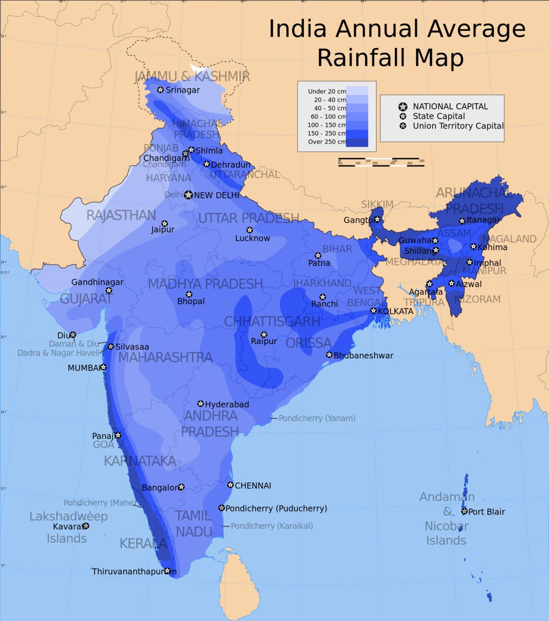
Map of Annual Average Rainfall (cm) in India

This photo shows a map of the average annual rainfall in the different regions of India. The rainfall is highest in two distinct regions, the Western Ghats mountain range which runs in a very narrow region along the southwest coast of India, and the far northeast of the country.
Not coincidentally, these are the two regions of the country that produce most of India's tea. The tea plant is a moisture-loving plant, and as such, only certain regions of India are suited to growing it.
You can read more about this on our pages on India and its tea-growing regions, or more generally, our article on climate, geography, and tea production.
