
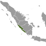
Bengkulu, Indonesia
Wikipedia: BengkuluUpdated: Nov. 15, 2017
Table of contents:
About Bengkulu, Indonesia | Styles of Tea Produced in Bengkulu, Indonesia | Examples of Bengkulu, Indonesia
About Bengkulu, Indonesia | Styles of Tea Produced in Bengkulu, Indonesia | Examples of Bengkulu, Indonesia
About Bengkulu, Indonesia
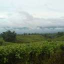
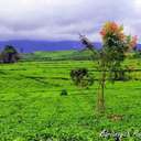
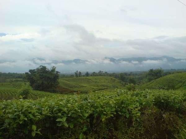 Kabawetan Tea Plantation, Kepahiang, Bengkulu, Indonesia, Photo © Ade Fajar Santoso (Panoramio), CC BY-ND 3.0.
Bengkulu is rich in natural resources and less developed than most of Sumatra. The climate is tropical with very high rainfall year round, owing in part to the Barisan Mountains that run along the length of the province on the inland border. In much of the region, the wettest season, October through December, averages over 14in (360mm) of rain, and even the drier months (June-July) average over 7in (180mm). Temperature varies little year-round and tends to vary only between about 70-80°F (22-33°C) night to day. Forests still cover 46% of the province and only 23% of these are classified as production forests.[1]
The Kabawetan tea plantation is located in Kepahiang, Bengkulu. Teas from this garden are available from a few retailers in the West.
References
1. Patricia G Patrick, Forests in Bengkulu and North Carolina, In: Preparing Informal Science Educators, Jan. 2017, pp. 393.
Styles of Tea Produced in Bengkulu, Indonesia
This is a selection, not an exhaustive listing, of the styles of tea most commonly produced in Bengkulu, Indonesia.

